- Travel time
- About 80 minutes from downtown Ottawa — 15 minutes west of Perth.
- Shaun's cell
- 613-277-7592
- [email protected]
- This page
- 101-32.christielake.club
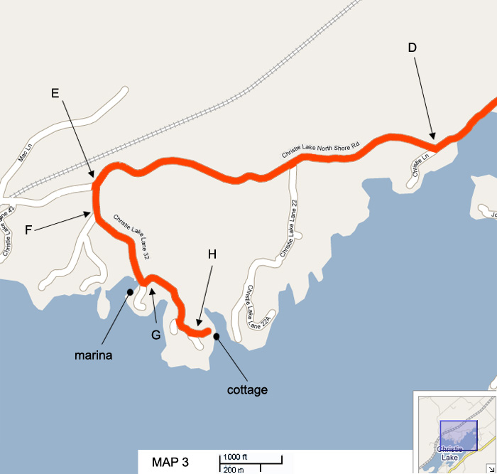
Open in Google Maps The pin is the right address, but the last stretch is unmarked gravel with no cell signal — have Map 3 to hand.
From Ottawa
-
Get on Highway 417 west
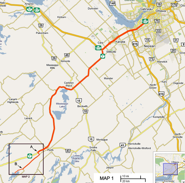
Shortly after the Carp Road exit the highway splits. Exit right and follow Highway 7 toward Toronto. You'll travel about 70 km, passing through Carleton Place and eventually entering the town of Perth.
-
A Left at the Glen Tay Road lights
Continue through Perth and stay on the highway until you reach a set of lights at Glen Tay Road. If you pass the truck way-station, you've gone too far.
Turn left onto Glen Tay Road, cross the railroad tracks, and continue a short distance to a 'T' junction — turn right there onto Christie Lake Road.
-
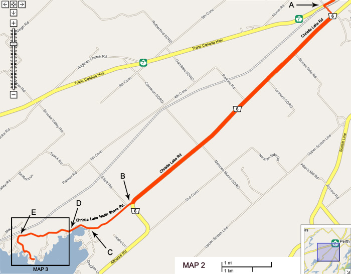
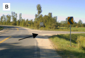
B Right onto Christie Lake North Shore Road
Continue until the road curves to the left. At the curve, take a right.
-
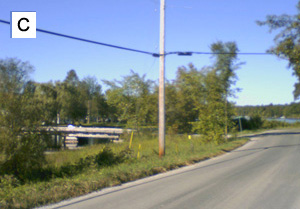
C Past the campground and bridge
Continue on this road for 4 km. You'll pass a trailer campground and a bridge on your left, shortly after which the road turns to gravel.
-
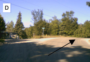
D Ignore the side roads — keep going
There are a few side roads along the way. Don't take them.
-
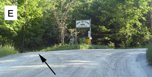
E Left at the Christie Lake Marina signpost
Keep going until you reach what almost looks like a 'Y' junction, with a post carrying many signs — one of them for Christie Lake Marina. Go left here.
-
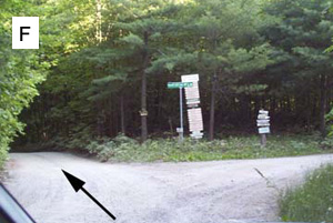
F Left again onto Christie Lake Lane 32
You'll quickly come upon a second junction — take another left. You're now on Christie Lake Lane 32.
-
G Over the bridge, then immediate left
The road gets dark and spooky and your cell phone will probably cut out. You'll cross a small bridge with the marina on your right. Take an immediate left after the bridge, up the small hill, and continue on this road.
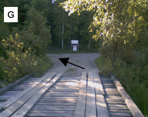
Note: the bridge has been rebuilt since this photo — it's metal now, not wood. Everything else about the turn is the same. -
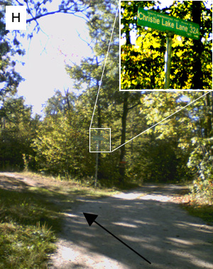
H Left before the Lane 32A sign
After about 400 m you'll come close to the end of the road, where it begins to branch into several lanes. Turn left before the green 'Christie Lake Lane 32A' sign.
-
Arrive — park by the blue '101' sign
Keep straight and you'll enter an opening with a circular driveway and a large beige garage at its centre. Follow the driveway around and park in one of the three spots left of the blue '101' sign.
If you need additional parking, park in front of the beige garage — but not in the spaces across from it, as those belong to the neighbour. Try to avoid blocking the roundabout.
The steps down to the cottage are to the right of the blue '101' sign. If you have a lot of stuff, or anything heavy to carry, leave it at the elevator.
Maps
Three nested views, each zooming into the box drawn on the one before. The lettered markers match the steps above.